SkyGIS adds clearance analysis and a redesigned workspace
The October 2026 update brings point cloud clearance checks, richer road and railway reporting, broader panoramic support, and a refreshed interface across SkyGIS Viewer and Pro.
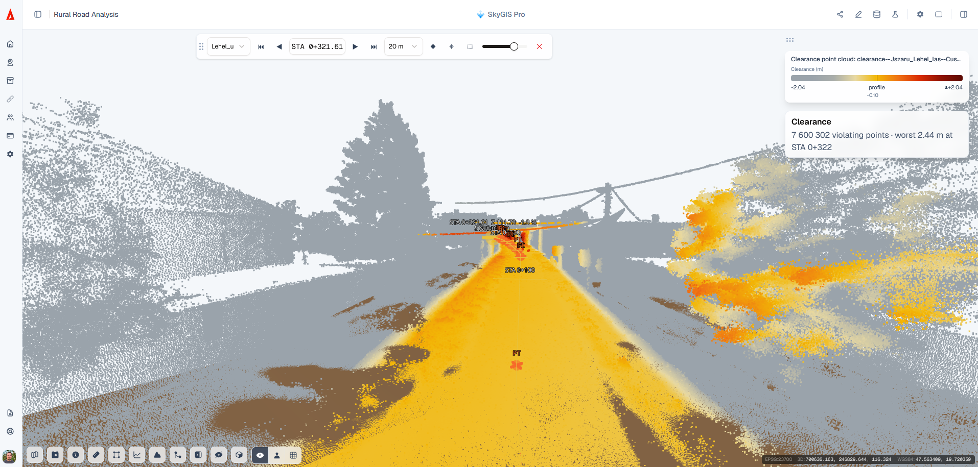
The October 26, 2026 release brings new tools for point cloud clearance checks, richer infrastructure reporting, and a refreshed interface across SkyGIS Viewer and Pro.
Spatial analysis involves more than running a calculation. Teams need to find the right tool, inspect the result, and carry useful information into the next stage of a project. The latest SkyGIS update improves that workflow with a redesigned workspace, new clearance analysis capabilities, broader panoramic image support, and better access to shared scenes on smartphones.
A clearer workspace for analysis
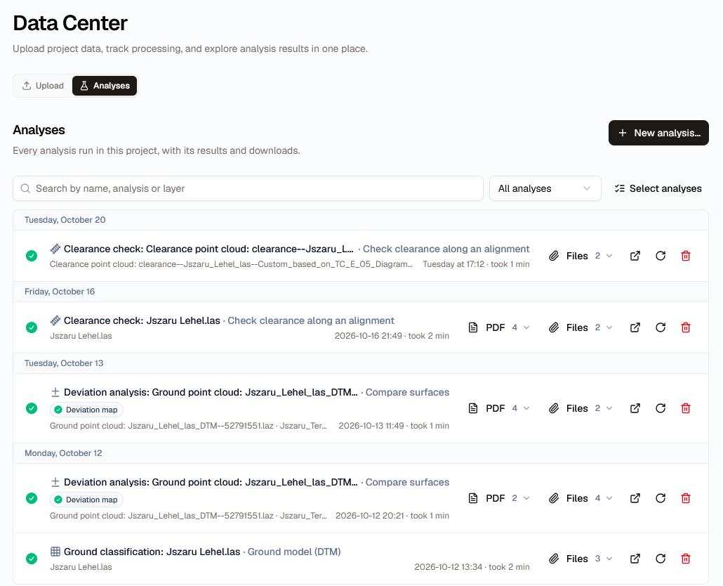
The refreshed interface brings updated Data Center views, context menus, and icons to both SkyGIS Viewer and Pro. In SkyGIS Pro, a dedicated Analysis panel gives users a central place to configure and launch analytical workflows.
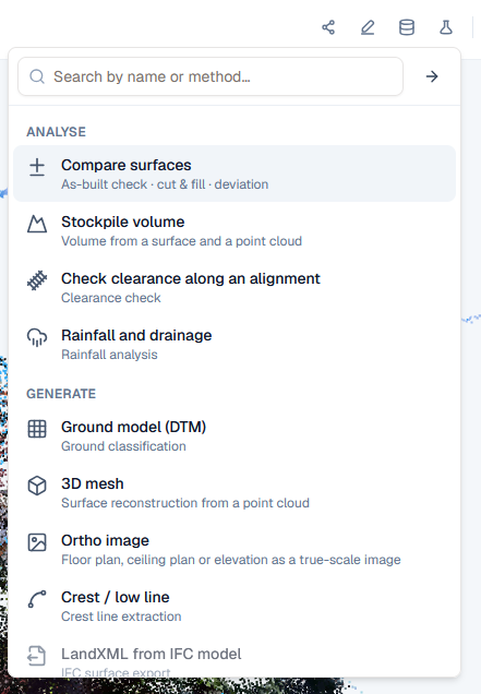
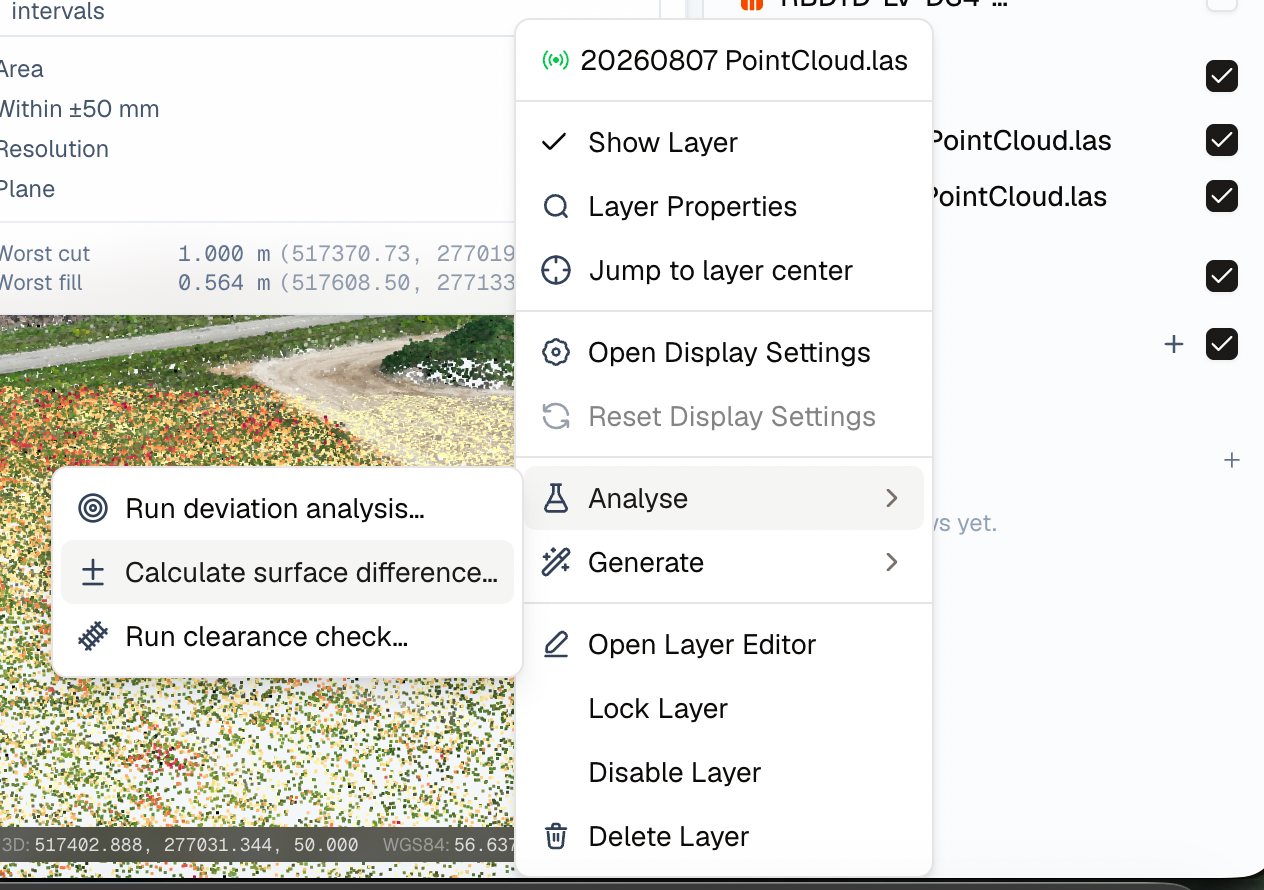
Analysis can also start directly from a layer, keeping the action close to the dataset being inspected. Results are accessible from both the Layer Panel and the Data Center, so teams can return to their outputs through either part of the workspace.
Clearance checks directly in point clouds
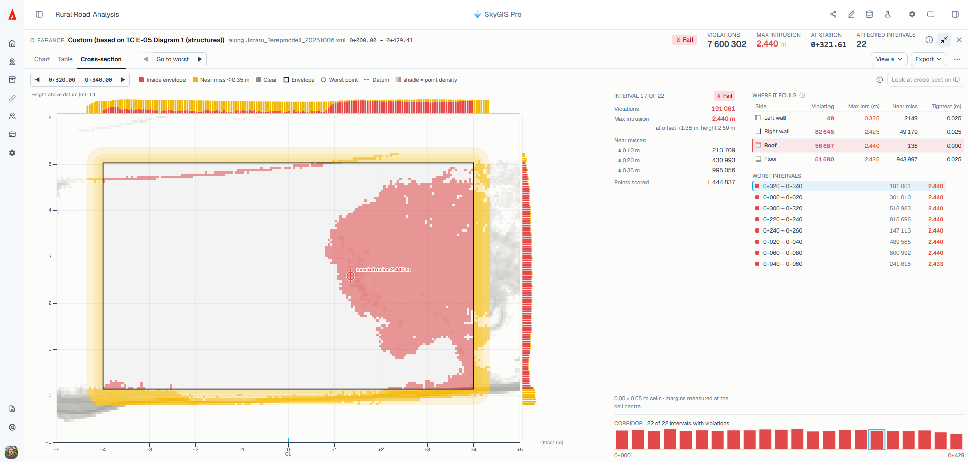
The first release of the Clearance Toolkit adds a new analysis workflow to SkyGIS Pro. Users define a 3D axis or alignment, then check the surrounding point cloud for objects that enter a clearance envelope. Standard envelopes and custom tolerance thresholds support different project requirements.
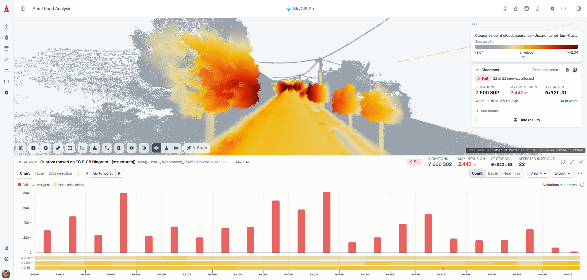
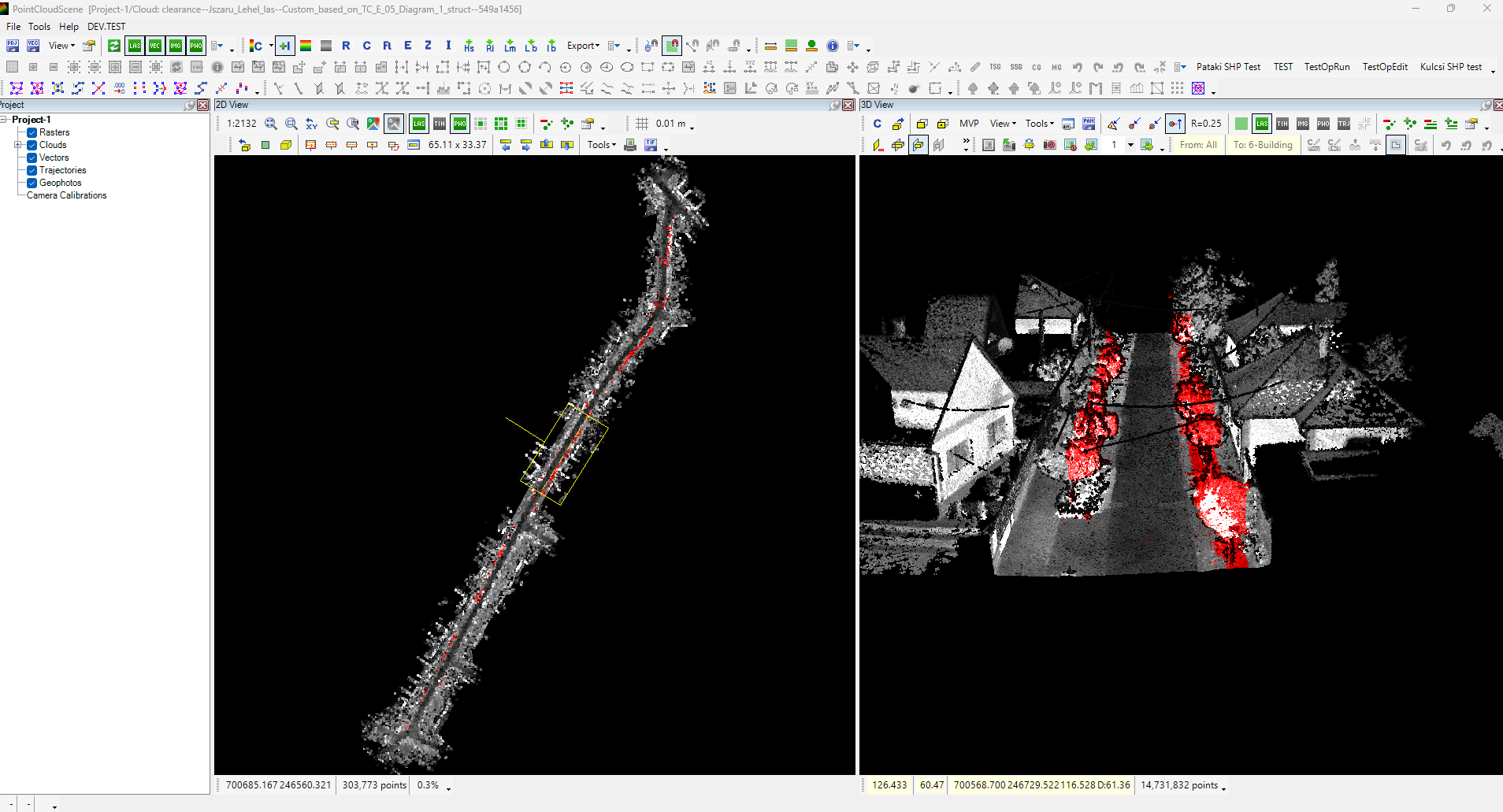
Results can be reviewed in cross sections and documented in reports. The toolkit also produces classified point clouds for use in downstream CAD and GIS applications, allowing the findings to remain useful beyond the initial analysis.
More detail for road and railway projects
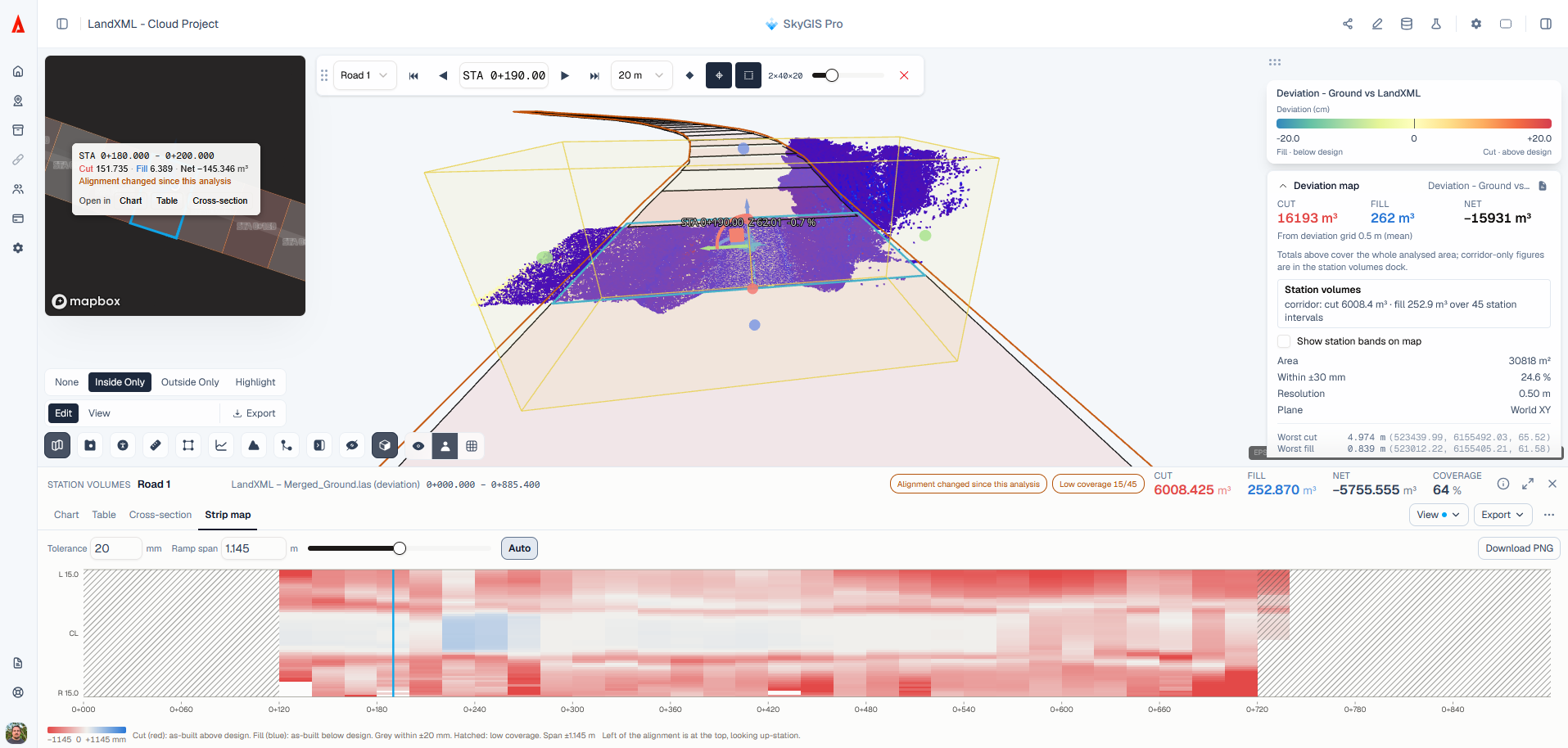
The Road and Railway toolkit receives further improvements following feedback on its earlier launch. Charts and reports now provide richer information, while display settings and export options give users more flexibility in presenting their results.
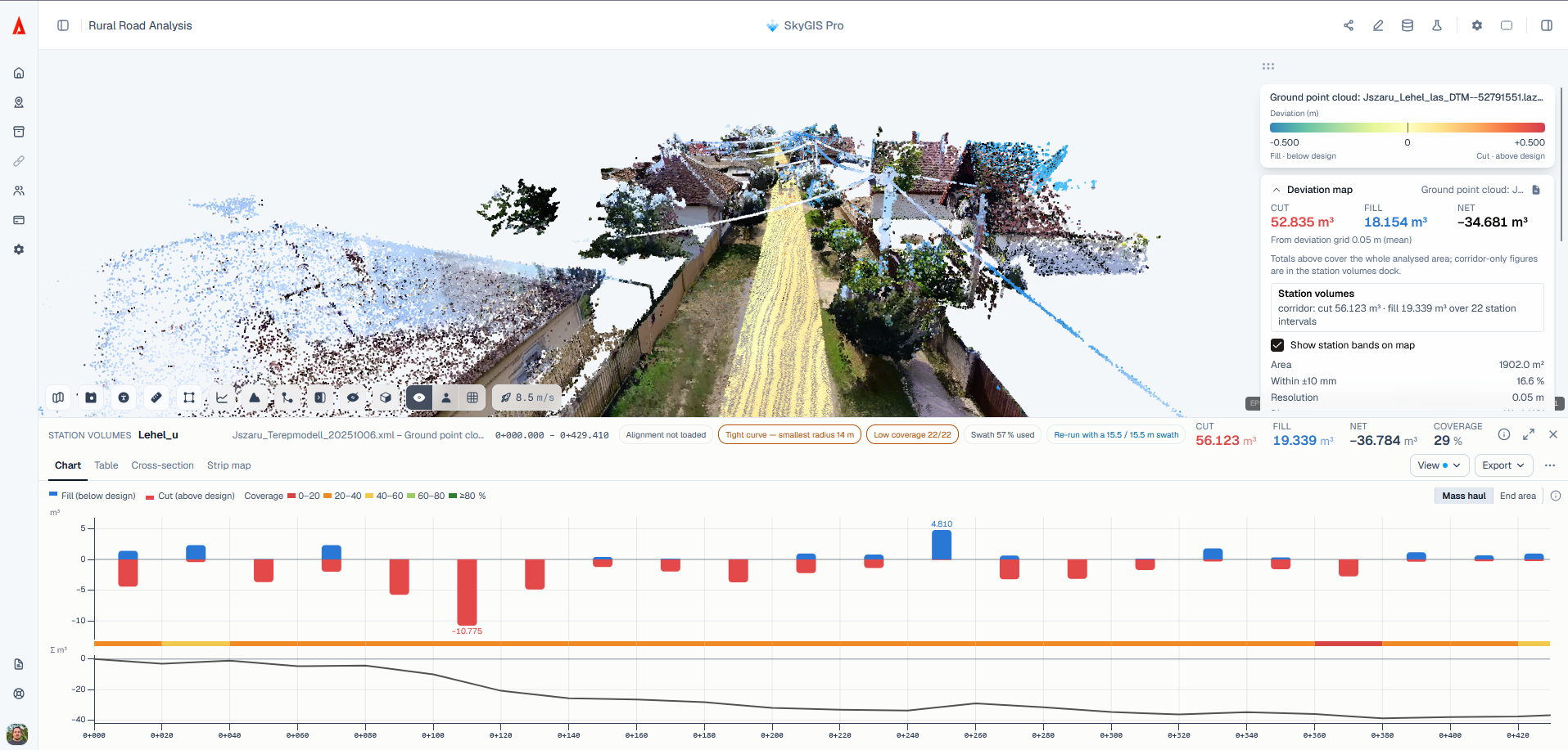
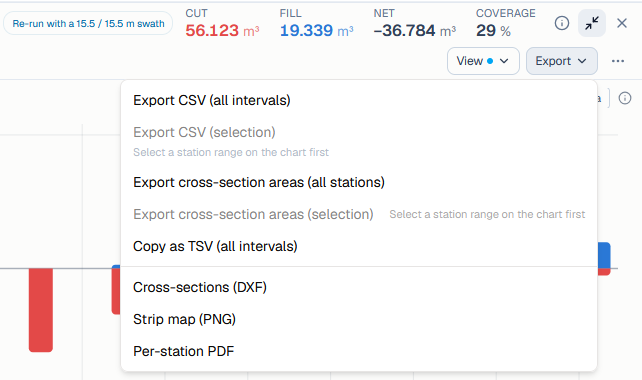
The enhanced map view includes station information and strip maps, providing more context when reviewing results along an alignment.
Broader panoramic support and E57 conversion
This release expands support for standard and manufacturer-specific panoramic image formats, including native E57 panoramas. A partner banner on skygis.cloud highlights verified manufacturer integrations. Users whose hardware is not listed can contact the SkyGIS team to check compatibility.

SkyGIS Pro also introduces extraction and conversion of panoramic images embedded in E57 files to TopoDOT’s IPRJ format. This lets teams separate imagery from an E57 dataset for use in other software. It complements the existing E57-to-LAZ point cloud conversion, which is available across all SkyGIS plans.
Shared scenes that work better in the field
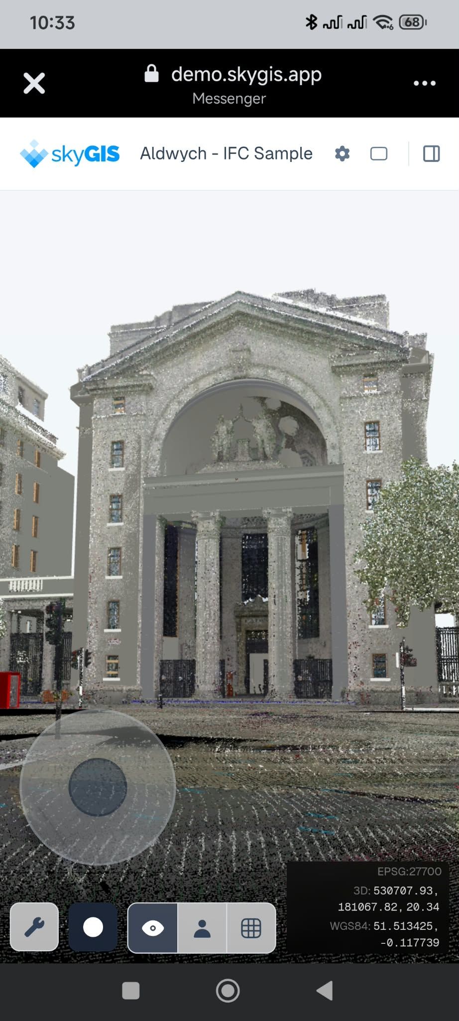
The mobile experience for SkyGIS Shared Links has been refined for smartphone screens. Updated touch controls and a cleaner viewport help colleagues and clients navigate shared 3D scenes, inspect datasets, and take spatial measurements while on site.
A project link can be sent through a preferred messaging app, giving recipients a practical way to review the scene from their phones.
Elevation profiles with automated reports
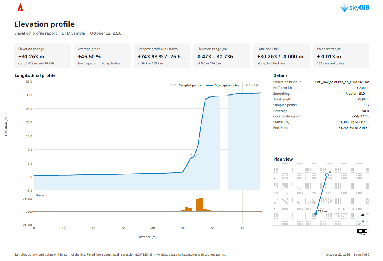
The Elevation Profile tool now includes detailed automated reporting across all tiers, including SkyGIS Viewer. Drawing a transect across the terrain reveals elevation changes along the selected path, and the generated report brings the key profile metrics together.
Adjustable smoothing controls help filter surface noise and tailor the profile’s appearance to the task.
Improvements across everyday workflows
Several smaller changes support routine project work. Folder workflows and context menus have been refined, uploads and processing include additional guidance and validation warnings, and Saved Views now offer configurable Initial View presets. Shared Links also receive updated interface and Clip Box controls, alongside a new camera selector icon.
Data display has expanded with 2D map rendering for LandXML and IFC files and orthophoto support for paired JPG and JGW files. The update also improves CAD styling and vector symbology in 2D maps, plus the handling of 2D layers and annotations within the 3D viewport.
For analysis and layer management, multi-select enables batch actions in the Layer Panel. Classification filtering in the Analysis Panel lets users run analyses on selected point classes, while vector extraction tools receive accuracy and performance improvements.
Source and images: SkyGIS changelog published October 26, 2026.